Skeda:Un-greece.png
Dokument origjinal (3.039 × 2.403 pixela, madhësia e skedës: 2,05 MB, tipi MIME: image/png)
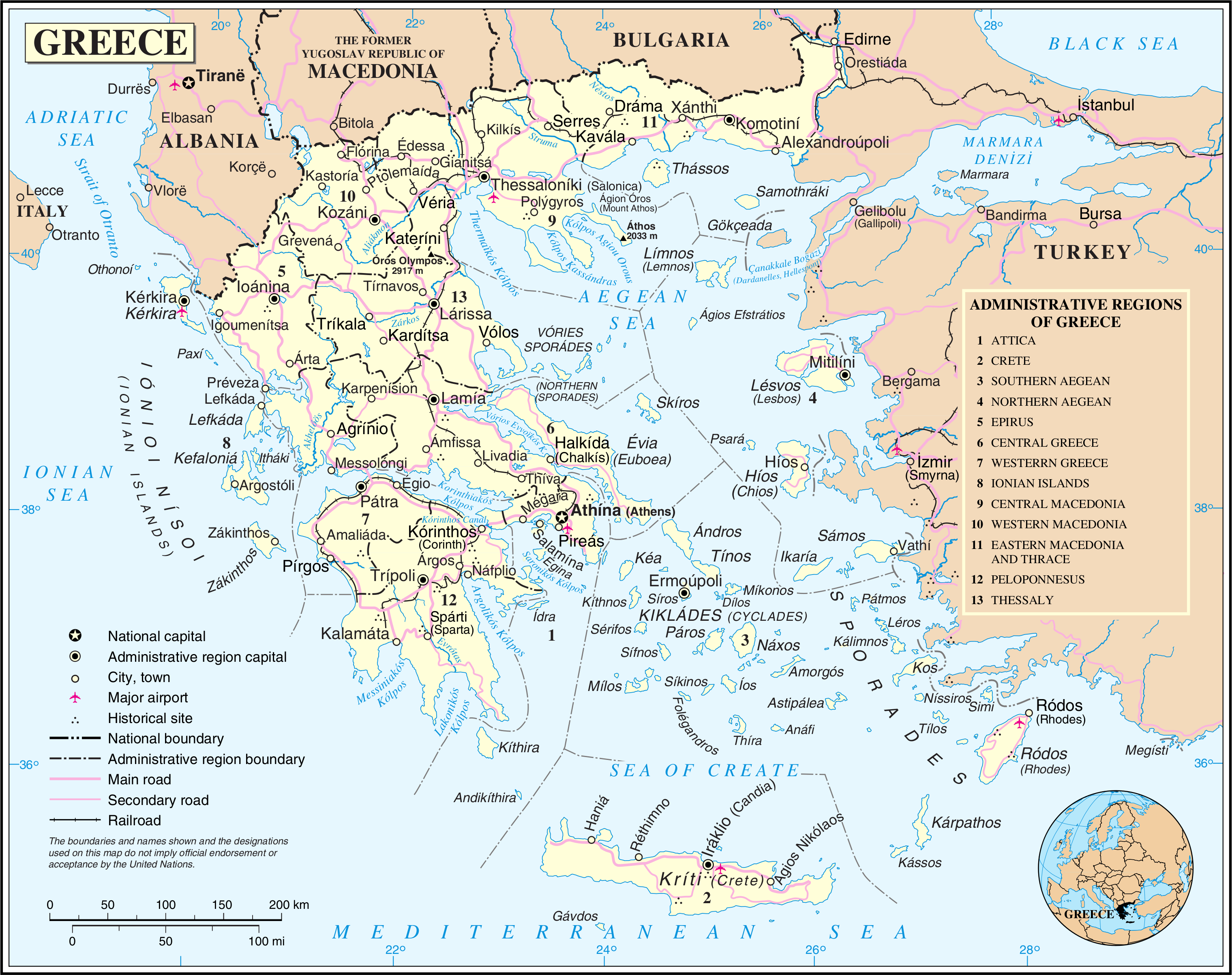
| This image is a map derived from a United Nations map.
Unless stated otherwise, UN maps are to be considered in the public domain. This applies worldwide. UN maps are, in principle, open source material and you can use them in your work or for making your own map. UN requests however that you delete the UN name, logo and reference number upon any modification to the map. Content of your map will be your responsibility. You can state in your publication, if you wish, something like: based on UN map … (map name, map number, revision number and date). See: Geospatial Information Section. And: Geospatial, location data for a better world. |
 |
Historiku i dosjes
Shtypni një datë/kohë për ta parë skedën ashtu si dukej në atë kohë.
| Data/Ora | Miniaturë | Përmasa | Përdoruesi | Koment | |
|---|---|---|---|---|---|
| e tanishme | 24 tetor 2007 03:04 | | 3.039 × 2.403 (2,05 MB) | Jeroen | {{UN map}} Category:Maps of Greece |
Përdorimi i skedës
faqe lidhet tek kjo skedë:
Përdorimi global i skedës
Kjo skedë përdoret nga Wiki të tjera në vijim:
- Përdorimi në bn.wikipedia.org
- Përdorimi në de.wikipedia.org
- Përdorimi në de.wikinews.org
- Përdorimi në en.wikipedia.org
- Përdorimi në id.wikipedia.org
- Përdorimi në ku.wikipedia.org
- Përdorimi në lt.wikipedia.org
- Përdorimi në nl.wikipedia.org
- Përdorimi në nl.wikivoyage.org
- Përdorimi në pl.wiktionary.org
- Përdorimi në vi.wikipedia.org
- Përdorimi në www.wikidata.org